The weather has been very fine for the past month; so fine, in fact, that there is a real danger of drought and there have been extensive heath and forest fires in some parts of England. We therefore find ourselves in the unusual position of actually wishing rain would come, a wish that has been answered with some showers in the past couple days. Yesterday was just such a mixture of sunshine and showers when my friend John and I went to view the site of the Battle of Towton (1461). We share a passion for military history and this was to be John’s introduction to the pleasure of reconnoitring an historic battlefield.
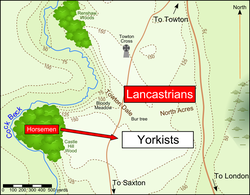
As its name implies, the Battle of Towton was fought just south of the village of Towton (North Yorkshire) in the dynastic struggle known as the Wars of the Roses. On a cold and snowy Palm Sunday on 29 March, 1461, the Yorkist and Lancastrian armies faced each other across the open fields between Towton and Saxton. With about 50,000 men on each side, the two armies were about evenly matched and most of the battle (except for an attempted ambush by the Lancastrians) consisted of a brutal, head-on confrontation fought with longbows, edged weapons and a few rather unreliable handguns. Towards the end of the day, fresh Yorkist reinforcements arrived on the field, causing the exhausted Lancastrians to lose heart. They broke and fled, both into the valley to the west and northwards in the direction of Tadcaster. In both directions, however, they were hindered in their flight by the swollen stream known as Cock Beck. Thronging to cross by ford or bridge, they were drowned, trampled or slaughtered in their thousands by pursuing Yorkist cavalry. Even those taken prisoner were mutilated and then hacked or bludgeoned to death, as confirmed by recent archaeological finds. Towton was therefore the bloodiest battle ever fought on English soil. (Battle map from Wikipedia Commons.)
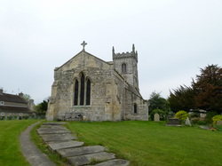
I had visited the battlefield once before, some ten years ago, but I was to see some new and enjoyable developments as well as having a companion with whom to exchange thoughts. Furthermore, I had toured the area by motorbike, thereby probably missing some features; this time our tour was to be on foot, a walk of about 8 miles. We started at All Saints’ Church in Saxton, in the vicinity of which the Yorkist army camped on the night before the battle. The church and its surrounding yard are full of history.
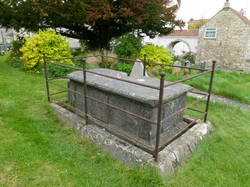
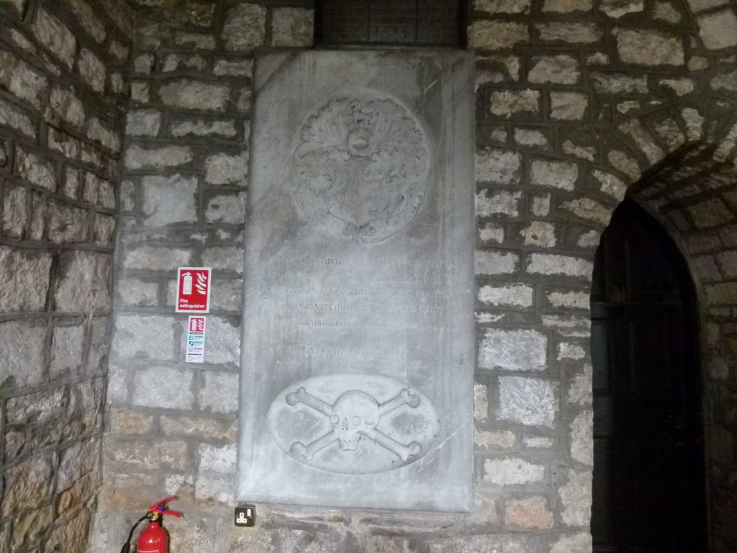
Close to the east end of the church is the grave of Ranulf, Lord Dacre, who was killed by an arrow in the battle. There is a legend that Lord Dacre was buried upright on the back of his horse. This seems improbable, but excavations in the mid-nineteenth century confirmed the presence of a horse’s bones, so he may well have been buried with his horse.
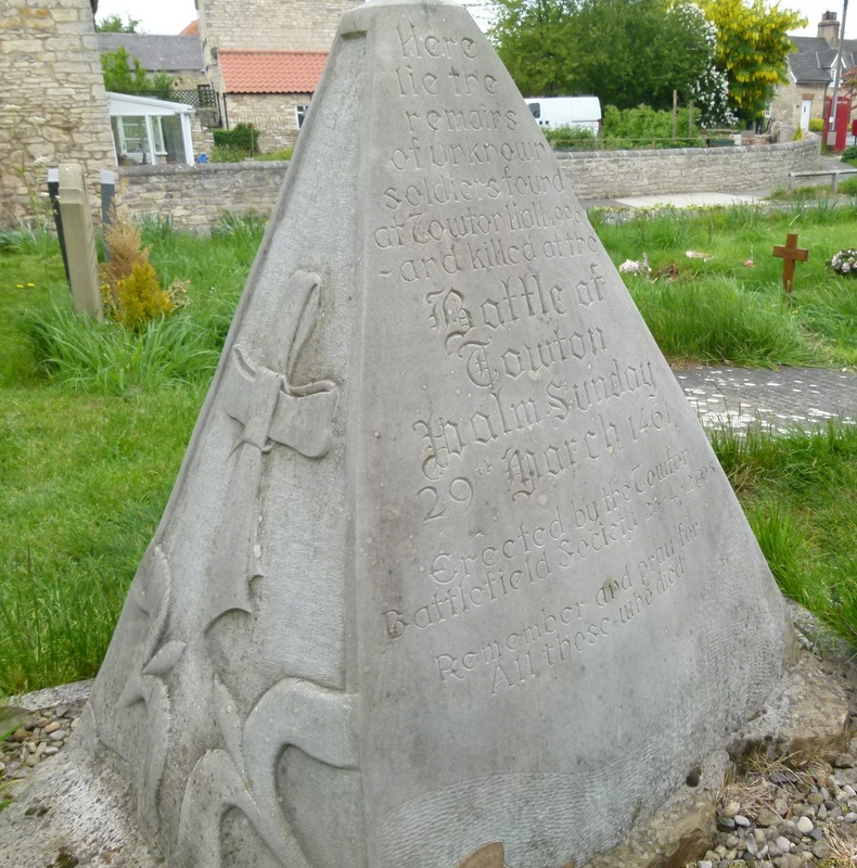
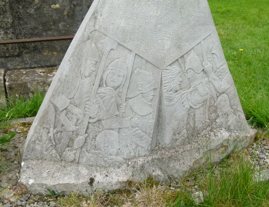
Next to Dacre’s grave is a stone memorial to the dead of the battle, recently erected by Towton Battlefield Society (TBS).
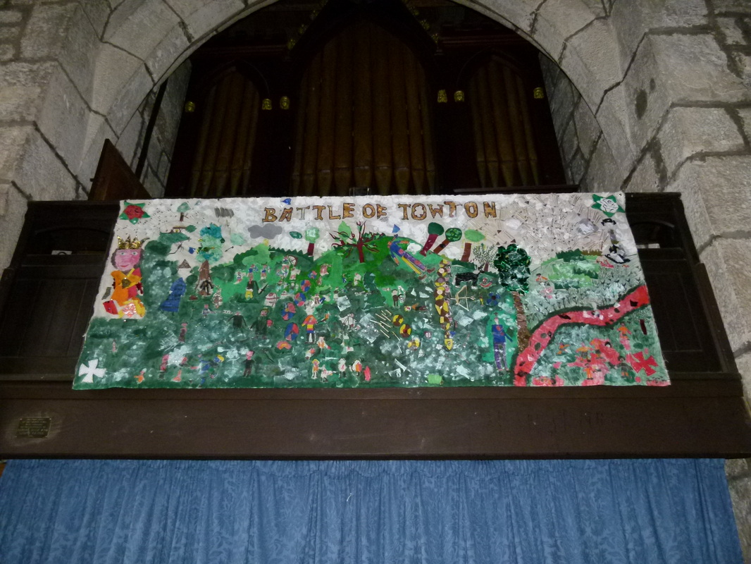
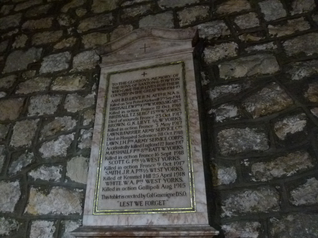
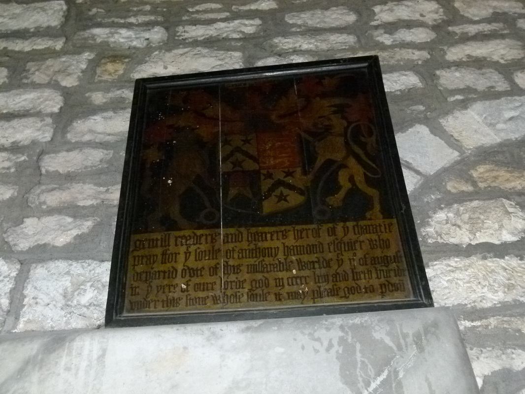
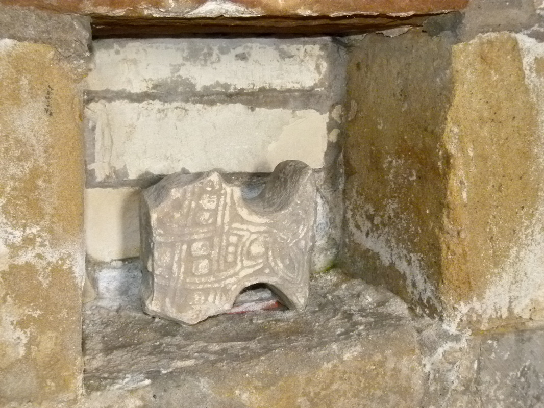
The inside of the church is also replete with history, from a fragment of a stone cross, ancient monuments to the dead and a memorial to men of the village who died in World War 1, to a colourful collage created by the local children.
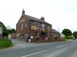
From the church we walked about half a mile to the ‘Crooked Billet’ pub, where it is said the Yorkist leaders may have found accommodation (not in the modern building of course!) As it was already time for lunch, we had a pint of Black Sheep ale there while viewing framed prints depicting the battle.
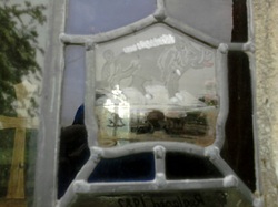
Continuing on our way, we made a slight detour to visit Lead Chapel, a small but ancient chapel standing in the middle of a field. Although it is no longer used for regular worship, it is still maintained in good condition and a stained glass piece depicting a boar (the personal device of Richard III) was added to the small window panes in 1982.
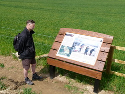
For much of our route, we had to walk at the side of the main road, walking along the grass verges where possible and keeping a wary eye out for traffic whenever we had to leave the verges. Soon, however, John spotted an information board in a field to our right, the first of many that we were to come across. These are new additions, installed by the TBS and the Royal Armouries. This is the new development of which I spoke, for they were not there on my first trip, and they greatly enhance the visitor’s enjoyment and appreciation of this historic site. Footpaths have also been created, thanks to the cooperation of the local landowners, so that some of the tour, at least, can be taken away from the danger and inconvenience of road traffic. From various vantage points, with the aid of these boards, we were able to gain a better understanding of the ground to tell us why, 550 years ago, the armies had chosen to fight on this spot and what advantages and disadvantages the terrain held.
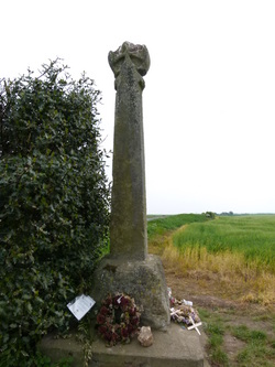
We crossed the main road again to view (as well as the new information boards) the stone cross erected in 1928 to commemorate the battle, before the footpath took us to the edge of the Cock Beck valley. The latter was a view that I had not seen previously, as I had been with the motorbike and unsure whether I would be venturing onto private land. Looking down, we could see the meandering course of the beck, the possible crossing points and ‘Bloody Meadow’ where so many of the fleeing Lancastrians were slaughtered. The beck didn’t look very much of an obstacle on the day of our tour; it looked as if one could leap across it easily, and we fell to discussing this matter. We soon realised the factors that would have made it more formidable. First of all, the beck is now diminished by lack of rain but it may have been swollen considerably on the day of the battle. Secondly, the routing soldiers would be weighed down by their armour. I know from re-enactment experience that it takes some time and effort to get armour on or off. Thirdly, the refugees would be already exhausted by the day’s fighting and the hectic flight from the plateau to the dale. A contemporary account states that the beck was so choked with corpses that the living could cross dry-shod and that blood stained the water as far as the River Wharfe, into which Cock Beck issues.
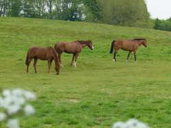
This part of the walk was the most pleasant, being well away from the road, and we were well able to take in the pleasant sounds and sights of the countryside, including a number of fine horses grazing in a field.
Having passed through Towton village, however, at the apex of this triangular battlefield, our route took us back to Saxton along a very busy road. Consulting our guide book, John estimated that we had about 2.5 miles to walk. “That’s alright”, I said, “If we don’t dawdle, we can be back in Saxton in less than an hour.” And so we set off again. John is much taller than me and has a longer stride, but he sets an easy pace that I can match without difficulty. There was a footpath of sorts at the side of the road, but it was overgrown with grass in places and strewn with rubbish and the occasional dead animal. Cars and motorbikes constantly whizzed past us in both directions, making conversation almost impossible, so that I retreated into my own thoughts and observations, noting how the ground to the left of the road was considerably lower and that on the right (the scene of the battle) considerably higher. I don’t know whether I began to tire or whether John began to quicken his pace, but I found it a little harder to keep up with him. Perhaps it was a combination of both, for as we came to the junction where could turn right onto a much quieter road back into Saxton we needed to consult the map again. John confessed that he had rather lost his sense of distance and that it seemed we had been on ‘that bloody road’ for an eternity. I agreed with him, although my watch showed that we had covered this stretch in only 40 minutes.
Soon we were back at the car, at our starting point next to Saxton’s church. A few more swigs from our water bottles helped to rehydrate us and then we drove back to Harrogate. It had been a highly enjoyable day of healthy exercise, appreciation of history and military tactics, and comradeship. We are already planning our next trip to Marston Moor, the scene of a key battle (1644) in the English Civil War.
If you would like to know more about the Battle of Towton and the arms and armour of the period, I can recommend the following websites.
Wikipedia entry on the battle: http://en.wikipedia.org/wiki/Battle_of_Towton
Towton Battlefield Society: http://www.towton.org.uk/
Royal Armouries (Leeds): http://www.royalarmouries.org/visit-us/leeds
Wikipedia entry on the battle: http://en.wikipedia.org/wiki/Battle_of_Towton
Towton Battlefield Society: http://www.towton.org.uk/
Royal Armouries (Leeds): http://www.royalarmouries.org/visit-us/leeds
 RSS Feed